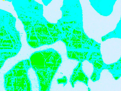


 (NW Georgia, saturated & resaturated)
This series is directly influenced by Andrei Molotiu's
latest work (the world is an abstract comic).
Andrei has been championing Abstract Comics for quite some time now and is the editor of an essential forthcoming anthology of abstract comics to be published by Fantagraphics.
If you are unfamiliar with his work, it really is an eye-pleasing treat to go thru all his stuff posted on BLOTCOMICS.
Viewing his latest operations involving airplane-window Earth surfaces, I was prompted to think of cartosemiotics & geolinguistics --- something I had never really considered much before & now a topic I'm motivated to research further, here's a few links of interesting stuff so far:
(oh yeah, the "wet string trick" is a technique
map thieves employ to steal rare pages)
map thieves employ to steal rare pages)


2 kommentarer:
The report is reproduced here by kind permission of Cartographiti, the newsletter of the Map Curators' Group of the British Cartographic Society, No. 79 (Summer 2007): 11-16, and the author. It was placed on the web on 4 October 2007.
While those restrictions are good, they will not protect against many of the tools favored by book and page thieves who remove pages from books to sell individually. These tools are quite small and can easily be smuggled into a research space. For example, it is easy to extract individual pages from a book by tearing along the edge of a metal or plastic ruler, or by cutting them with an X-Acto knife.
Thieves also use the "wet string" method, in which a foot-long piece of cotton twine is soaked in the mouth and then placed inside the book to dampen the edge of the page. Once the page is damp it can easily be torn from the book.
Within framework of cartography the cartosemiotics is a new discipline studying features of cartosemiotic models (from the standpoint of modelling, communication and cognition) with the goal of acquisition of new spatial knowledge or revitalization of forgotten spatial information. Cartosemiotic
models are cartographic, map-like, and cartographic-textual products in electronic form and non electronic one (e.g. traditional print form) of the human knowledge about earth (and its parts), planets and cosmos-referred features and relations.
/WOLODTSCHENKO 2003/.
asemicpsychedelic fun!
Legg inn en kommentar